The Manohar Lal Khattar-led Haryana government plans to go big on the use of drone technology by investing in the establishment of a company to help undertake aerial surveys, imaging, mapping and facilitate decision support activities for various organs of the government.
Officials said the soon to be incorporated government-owned company will be named Drone Imaging and Information Systems of Haryana (DRIISHYA).
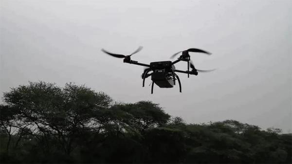
The company aims to provide innovative, flexible, and cost-effective drone-based geographical information solutions to the state government, he said. It will acquire, manage, operate and maintain drones and unmanned aerial vehicles (UAVs) as imaging and information collection platforms with sensors of various kinds.
Officials said the acquisition, management, operations and maintenance of drones will be in accordance with the guidelines of the director general of civil aviation and the central government.
Images and raw information collected will be processed at a data processing, applications and management centre to be established by the company. The base maps generated can be used along with other information layers for utilisation by departments in the state government.
Drones and pilots
Initially, the company plans to acquire around 20 drones and set up a data processing, applications and management centre at an approximate cost of Rs.20 crore. The share capital raised will be utilised to create assets such as drones, sensors, rovers, information systems hardware and applications software and licenses.
Headquartered at Karnal, DRIISHYA will utilise the facilities at Karnal airport for undertaking its operations. Officials said Karnal is centrally-located and has a landing strip which can be utilised for drone and UAV operations. The facilities at the Karnal airport can be used for testing and housing the drones with the sensors.
The company also plans to hire 10 trainee pilots who will be put through training for drone-flying operations at the flight civil aviation centre, Manesar. They will have to obtain the requisite licences from DGCA before deployment for drone operations.
The company will also recruit GIS professionals and experts in imaging, image processing, surveying, data processing and applications development. The CM will be the chairperson and the chief secretary will be the senior vice-chairperson of the company’s board.
Principal secretary to the CM, V Umashankar said drones and unmanned aerial systems have emerged as a cost-effective medium for imaging and location-based geographical information collection which on processing can provide decision support systems for governance.
“The state government has launched a project for imaging and mapping properties through a large-scale mapping project where drones were used as the platform for capturing high resolution aerial images for mapping activities. With the growing use of drones and UAVs for imaging and information collection, we felt a need to set up a government corporation,’’ he said.
From urban planning, mining to crowd control
Officials said DRIISHYA will provide imaging, processing, information collection and analysis, and decision support systems to the town and country planning department for urban development planning and identifying unauthorised colonisation.
Similarly, it will help in assessment of mining activities in mining zones, will be used for property assessment and spotting unauthorised constructions in municipal areas, used for updating land maps and records.
“It can also provide planning support for construction of roads and canals, crowd monitoring by the police, forest protection and management activities. It will act as a repository for geographical imaging and information systems,” Umashankar said.
DRIISHYA’S MANDATE
- Conduct drone-based activities to provide authentic and quality imaging data with analytics for aiding good governance
- Do aerial surveys, cadastral mapping, land records, base maps for planning, aerial surveillance for law-and-order monitoring
- Build authentic data repository and analytics unit for servicing various geospatial requirements
- Recommend policy recommendations to expand and facilitate the ease of operations of drones